
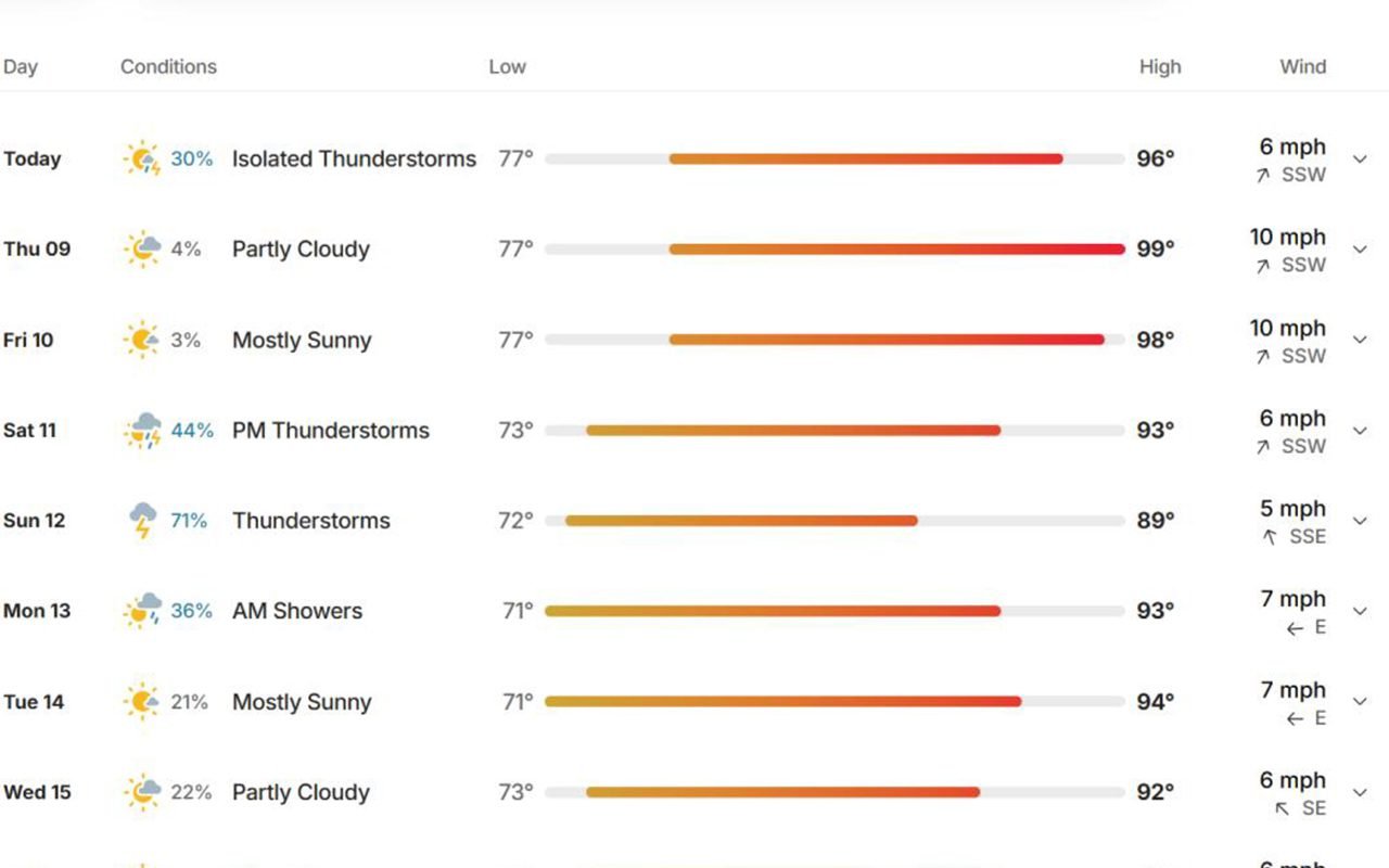
The heat returns in earnest today and builds through the coming week, with low storm chances possible each afternoon across southeast Oklahoma.
Today, Wednesday, July 8 — Sunny and hot with a high near 97. A low, isolated chance of afternoon showers or thunderstorms exists, mainly in the higher terrain. Heat index values will begin climbing — take precautions with outdoor activities and watch for signs of heat stress.
Thursday, July 9 — Mostly sunny and hotter, with a high near 99. Rain chances stay minimal. Heat indices continue climbing into the upper end of the danger zone; stay hydrated and limit strenuous outdoor activity during peak afternoon hours.
Friday, July 10 — Hot with a high near 99, and a better chance of afternoon storms returns as a disturbance moves through the Plains. Isolated storms could bring gusty winds and brief heavy rain, mainly focused across the higher terrain of southeast Oklahoma and western Arkansas.
Saturday, July 11 — Hot and humid continues, high near 97, with scattered afternoon storms still possible as the same pattern lingers.
Sunday, July 12 — Rain chances jump to 65 percent as a weak frontal boundary approaches, bringing better coverage of showers and storms. High near 88 — a real break from the heat after several days near or above the century mark in heat index.
The bottom line: This is shaping up to be the hottest stretch of the summer so far, with heat index values likely climbing into the 105-plus range by Thursday and Friday. Stay hydrated, avoid the hottest part of the afternoon for strenuous outdoor work, wear light clothing, and check on elderly neighbors, kids and pets. Relief arrives by Sunday as rain chances increase heading into early next week.
Get more. Subscribe to our free daily newsletter